A year ago, on the RREV Pathfinder blog, we published From Chaos to Compass: Why We Built TrailSync. It opened with a line every overlander recognized instantly: “Every overlander knows the chaos of planning.” Eight apps open at once. A campsite app that says a road exists, a weather app that doesn't know what elevation you'll sleep at, a solar calculator in a spreadsheet, a route in your head. The chaos wasn't a missing feature in any one of those apps. It was the seams between them.
That article was a promise. This one is the receipt.
The Origin
We don't just build expedition vehicles. We build the software too.
RREV is an ecosystem. We spend our days engineering vehicles that keep people alive and comfortable hundreds of miles from pavement — power systems, water systems, the physics of weight and range — and we kept watching customers take delivery of a vehicle engineered to the kilowatt-hour, then plan their first expedition with a stack of consumer apps that didn't know that vehicle existed. The hardware was ours. The journey deserved to be too.
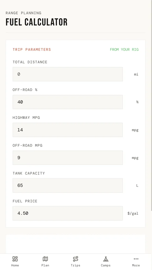
Your rig is not an abstraction. It gets 11 miles to the gallon, not “average.” It carries 46 gallons of fuel and 40 of water. It's 22 feet long, which decides which forest roads and which campsites are even options. Every planning tool we tried treated all of that as a detail. To us it's the entire problem.
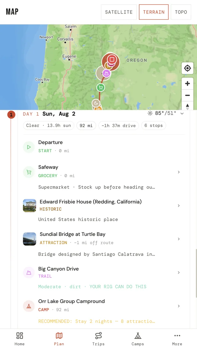
So TrailSync starts where an expedition actually starts: with the vehicle. Tell it your fuel capacity, your MPG, your water, your dimensions, and the route engine builds an itinerary a rig can actually run — fuel stops placed before the tank runs low, water fills where they exist, camp nights spaced to real daily range. Not a line on a map. A plan.
One Year On
What “solved” turned out to mean
When we wrote From Chaos to Compass, TrailSync was a conviction with a roadmap. Here is what it became.
A real campsite database, honestly sourced.
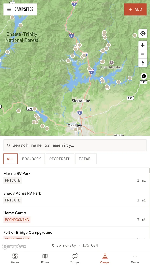
22,829 campsites across the US and Canada — US Forest Service, BLM, Recreation.gov, BC Recreation Sites, Parks Canada, Alberta Parks. All open government data, credited to its source. No scraped databases, no gray areas. And on top of that public foundation, a community layer: members add the spots that aren't in any government dataset, and — this is the part we're proud of — confirm conditions from the site itself. The app knows you're actually standing there. A confirmation from someone physically at a campsite last Tuesday is worth more than a hundred armchair reviews, and TrailSync knows the difference.
Safety data that's alive.
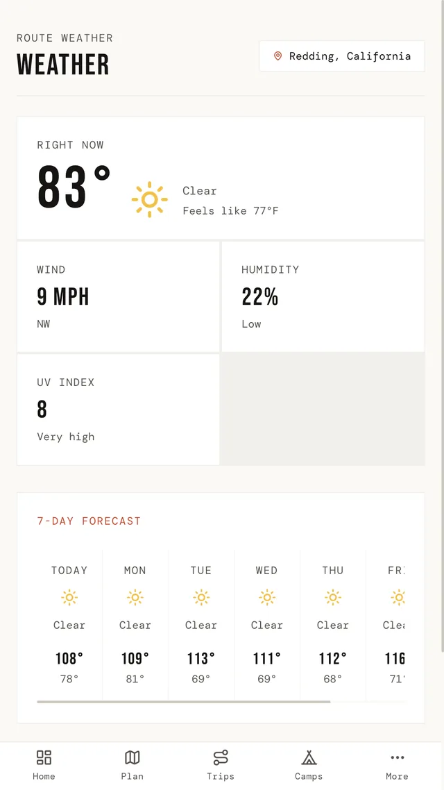
Plan a route and TrailSync scans a 50-mile corridor around it for active wildfires from the National Interagency Fire Center — and re-checks every time you open a saved trip, because a plan made in June needs to know about the fire that started in August. Weather goes deeper than a forecast: barometric pressure and trend (the oldest storm warning there is), air quality, UV, and a solar forecast matched to your panels.
The rig, live, inside the plan.
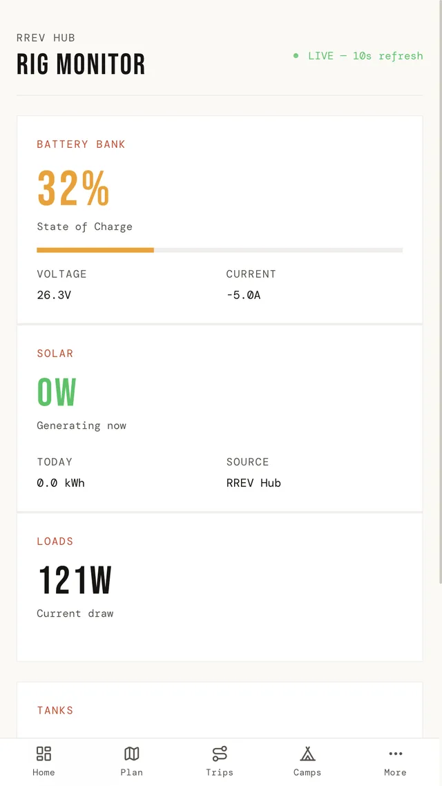
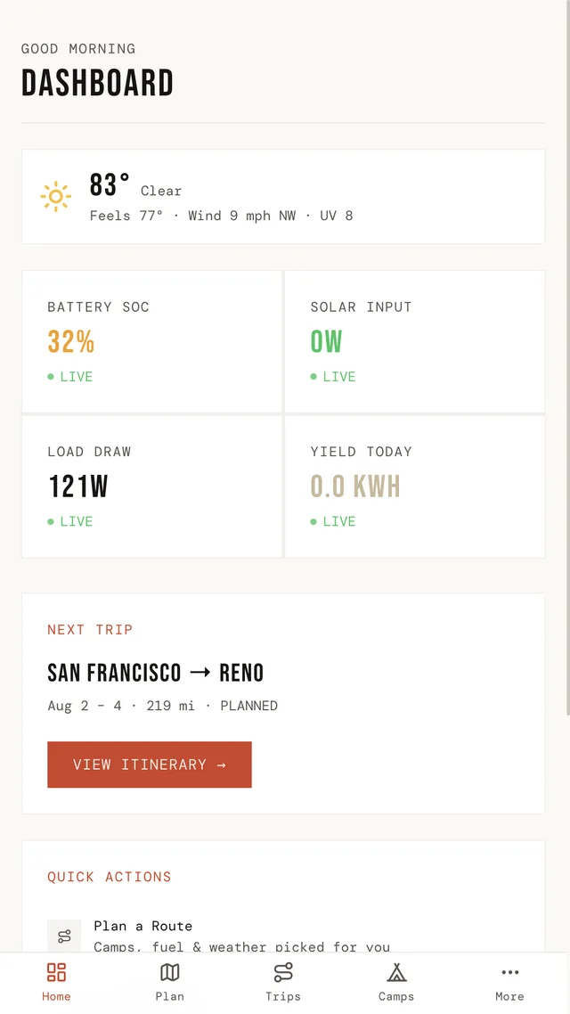
This is the piece no one else has, because no one else builds vehicles. Connect Victron VRM or an RREV Hub and the same app that planned your trip shows your battery state of charge, solar harvest, loads, and tank levels — live. The energy model tells you whether tomorrow's camp gets enough sun to cover tonight's draw. Planning and monitoring were never two problems. They were one problem the industry had split in half.
Built for where there's no signal.
TrailSync is offline-first because overlanding is offline-first. Trips cache to the device. Campsite confirmations and trail logs queue up and sync when you find bars again. The app assumes disconnection, because we do.
A record of the journey.
When your departure window arrives, TrailSync notices and nudges you to start the trip. From there, the Trail Log stamps every photo with coordinates, site, date, and trip day — automatically, in the moment, the way expedition logs used to be kept. When you're home, the trip becomes a story: your route drawing itself across the map from start to finish, exportable as video, ready for the group chat or the feed.
A community with standing.
Contribution earns rank — Traveler, Scout, Pathfinder, Trailblazer — based on sites added and conditions confirmed, not likes. The people improving the map for everyone are visible for it.
The Compass
The compass, one year on
From Chaos to Compass named the problem: the chaos was never any single missing app, it was the bouncing between them. The answer wasn't a better campsite app or a better weather app. It was one system that holds the whole expedition — vehicle, route, camps, weather, fire, power, memories — and keeps every piece aware of every other piece.
That's what “on plan” means in our tagline. Off grid is the point. On plan is how you stay there longer, safer, with your batteries full and your route clear.
TrailSync is free to start — plan trips, browse all 22,829 campsites, check fires and weather, and share a trip as an animated story. Pro adds unlimited saved trips, live rig telemetry, 100 AI route questions and 30 trip summaries a month, and unlimited Trail Log photos, with a 7-day trial to see if it earns a place in your cab.
The chaos got solved. Come see.
TrailSync is built by RREV — Roam Resilient Expedition Vehicles. Read the original announcement, From Chaos to Compass, on the Pathfinder blog.