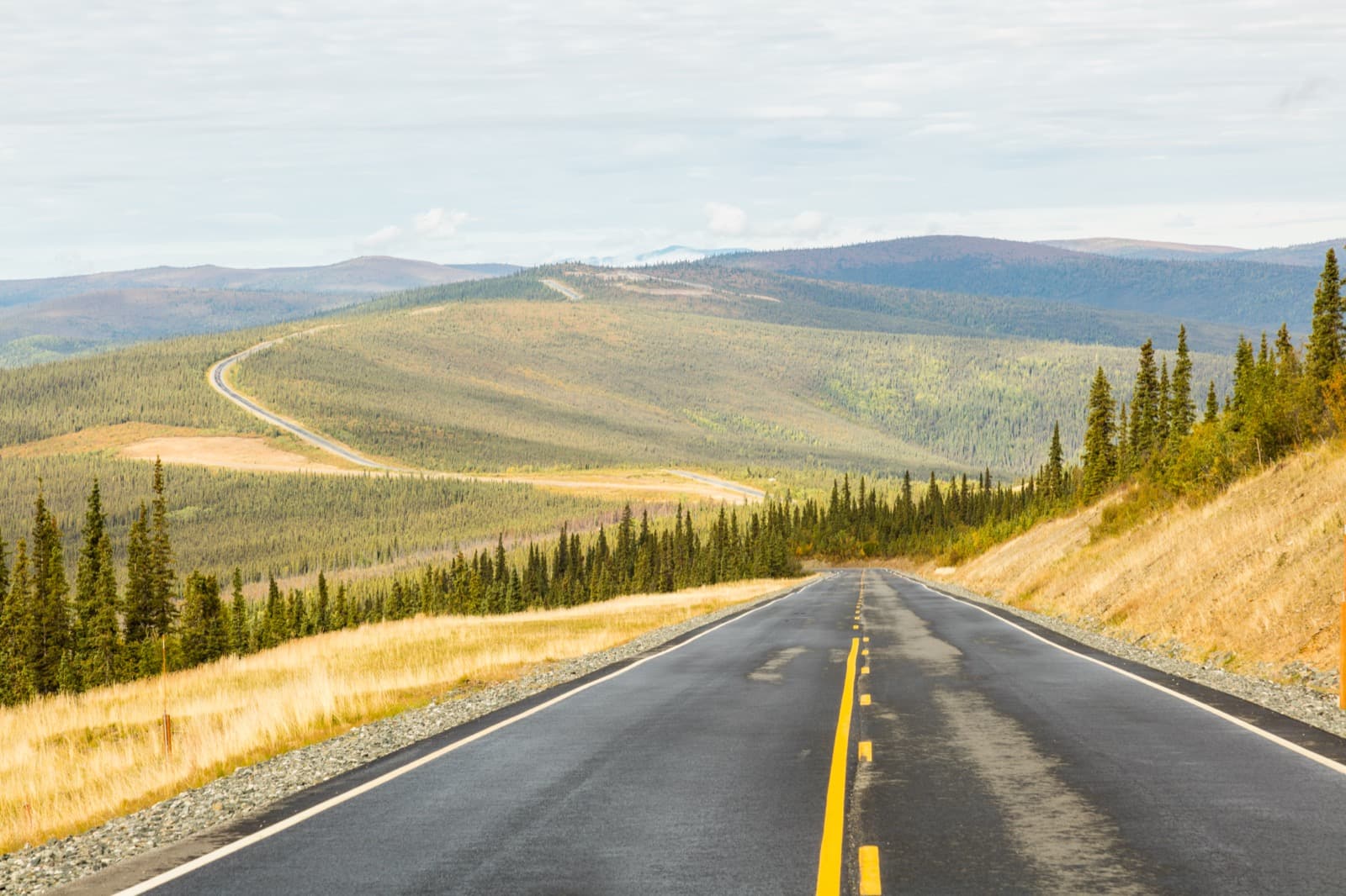
The northernmost border in North America.
Few roads feel as much like the top of something as this one. From Dawson City you ride the free George Black ferry across the Yukon River and climb onto a gravel ridge that runs, mostly above the treeline, all the way to the loneliest border post in North America — a single building with the international line painted on its floor. Then you drop into Alaska and the gold-camp hamlet of Chicken. The whole thing only works for a few months a year, and only within the border’s hours; plan it to the day.
Desk-researched September 21, 2026. Not field-tested. Distances are approximate driving budgets, not calculated routes, and remote-route services can close without notice — recheck every fuel, water and road source before you go.
Your itinerary.
01DAY 1 / Around townDawson City — gold-rush layover
Spend a day in Dawson before the crossing: pan for gold at free Claim No. 6 on Bonanza Creek, tour the Dredge No. 4 historic site, drive up the Midnight Dome for the view, and — if you dare — join the Sourtoe Cocktail Club. Fuel and provision fully; this is the last real town for a while.
- SUPPLY STOP
Dawson City, Yukon
Full services — groceries, fuel, water, hardware, visitor centre. Fill everything before the ferry; there are no services on the highway itself.
02DAY 2 / About 108 milesOver the top to Chicken
Take the free George Black ferry across the Yukon River and climb onto the ridge. Drive the exposed, gravel Top of the World Highway to the Poker Creek border — mind the hours — then descend the Boundary Spur and Taylor Highway into Chicken. Camp at the BLM Walker Fork campground.
- SUPPLY STOP
Poker Creek–Little Gold border
The northernmost land border crossing in North America (~4,127 ft), open seasonally with strict daily hours. Passports required. The line is painted on the floor of the shared building.
- SUPPLY STOP
Chicken, Alaska
Tiny seasonal gold camp — limited gas and diesel (cash-friendly, hours vary), café/saloon, gift shops, gold panning. No full grocery; treat water as unreliable.
- OVERNIGHT
Walker Fork Campground (BLM)
Taylor Hwy MP 82, near Chicken. ~24 sites, first come, open ~May–Sept. (Coordinate from campground databases — verify against BLM.)
03DAY 3 / About 78 milesChicken to Tok
Finish down the Taylor Highway — narrow and winding near Chicken, then paved (and frost-heaved) toward the Alaska Highway — to Tok and full services. From Tok you can chain onto the Alaska Highway in either direction.
- SUPPLY STOP
Tok, Alaska
Full services at the Taylor/Alaska Highway junction — fuel, groceries, lodging.
Where to call it a night.
Walker Fork Campground (BLM, Taylor Hwy MP 82)
~24 sites, first come, open roughly May–September. Confirm details against BLM before relying on it.
Check camping detailsYukon River Campground (Dawson, west bank)
Yukon-government campground right off the ferry at the start of Highway 9 — first come, fee. A convenient staging camp before the ridge.
Check camping detailsFuel, food & fresh water.
Fuel — Dawson, Chicken, Tok only
No services on the highway itself. Dawson→Chicken is ~108 mi with no fuel; Chicken→Tok ~78 mi. Chicken’s fuel is limited, seasonal and pricier. Leave Dawson full with a reserve.
Water & food
Stock up in Dawson (the only full town). Chicken has a café and limited food but no grocery; carry all drinking water for the crossing.
Before you point the rig north.
- Chip-seal then long gravel; a narrow, exposed ridge with steep grades, and hairpins on the Taylor Highway side past Jack Wade.
- Carry at least one full-size spare (two for remote gravel), a plug kit and compressor; air down for washboard.
- Passports are mandatory both directions, and the border keeps strict seasonal hours — arriving after close means turning back. Weather turns fast above 4,000 ft; pack cold layers even in July.
- No cell service across the highway or border; carry a satellite messenger and offline maps. The Jack Wade→Eagle spur is not advised for RVs/trailers; confirm ferry vehicle limits for a big rig.
Built by RREV. TrailSync comes from Roam Resilient Expedition Vehicles — these routes are made for our rigs.
- Outland Edition18 ft trailer · ~38 ft towed
- Baja Edition22 ft trailer · ~42 ft towed
- Titan Edition27 ft trailer · ~47 ft towed
- EXP Series & HD SeriesExpedition vehicles
Towed length adds a full-size tow vehicle (~20 ft). Set your build's real length in the planner and it fits the stops to it. Explore the builds →
Nearby & worth the detour.
The gems that turn a drive into the trip — detours, roadhouses, viewpoints and wildlife just off the line.
Free Claim No. 6, Bonanza Creek (Dawson)
Free public gold panning — keep what you find. Borrow pans at the Dawson visitor centre. Km 16 Bonanza Creek Road.
Dredge No. 4 National Historic Site
The largest wooden-hulled dredge in North America, on Bonanza Creek — Parks Canada tours tell the industrial gold-rush story.
The Sourtoe Cocktail (Downtown Hotel, Dawson)
A real mummified toe dropped in your drink — "your lips must touch the toe." A century-strong Dawson tradition, and a $2,500 fine if you swallow it.
Midnight Dome (Dawson overlook)
Drive up for a sweeping view of the Yukon River, the Klondike valley and the Ogilvie Mountains — and the start of the Top of the World ridge. Midnight sun and, later, aurora.
Ridge-line pullouts & aurora
The highway runs above treeline with 360° pullouts; late-August darkening skies bring the aurora back over the ridge.
Wildlife — Fortymile caribou, moose, bear
The Fortymile caribou herd, moose, grizzly and black bear and ptarmigan range the alpine tundra through the BLM Fortymile country.
Know what the plan is built on.
Land-manager information is linked below. These are planning suggestions, not reservations or a live report of road, campsite, water or fire conditions. Recheck before departure. If a stop is closed, omit it rather than finding an unverified shortcut.