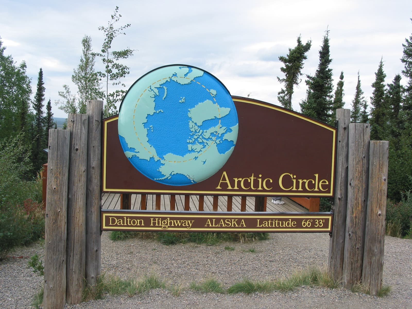
A road with nothing on it, all the way to 66°33′.
The Dalton is the road the pipeline built, and it still belongs to the trucks. You drive it to stand at the Arctic Circle, to watch the pipeline snake across the tundra, and to feel how far a road can run with nothing on it. This guide takes you the reachable, rewarding half — Fairbanks to Coldfoot, the world’s northernmost truck stop — not the brutal 239-mile run beyond to Deadhorse. Fuel discipline is not optional here; this is the most consequential logistics of any guide we publish.
Desk-researched September 21, 2026. Not field-tested. Distances are approximate driving budgets, not calculated routes, and remote-route services can close without notice — recheck every fuel, water and road source before you go.
Your itinerary.
01DAY 1 / About 140 milesFairbanks to the Yukon River
Fill everything in Fairbanks — this is your last full services. Drive north through Fox and onto the Dalton, following the pipeline to the mighty Yukon River. Fuel at the Yukon River Camp if it is open (a host must activate the pump), and camp nearby at Five Mile.
- SUPPLY STOP
Fairbanks / Fox — full fuel & supplies
Last guaranteed fuel, groceries, water and a spare-tire check. There are no grocery stores along the highway; bring ready-to-eat food and all your water.
- SUPPLY STOP
E.L. Patton Yukon River Bridge & Camp
Dalton MP 56. Yukon River Camp sells unleaded and diesel seasonally — see the host to activate the pump; hours are limited and it is closed in winter. Café and river-view decks.
02DAY 2 / About 59 milesThe Yukon to the Arctic Circle
The signature day. Climb past the 86-Mile overlook and the granite tors of Finger Mountain, then stand at the Arctic Circle Wayside — 66°33′ north. Camp at the wayside (no water) or push a little farther. Late August brings the first aurora back to these skies.
- OPTIONAL OUTING
Finger Mountain Wayside (MP ~98)
Half-mile interpretive trail across alpine tundra to dramatic granite tors and panoramic views. Strong winds — hold your doors.
- OVERNIGHT
Arctic Circle Wayside (MP 115)
The 66°33′ crossing — sign, viewing deck, interpretive displays. Undeveloped campground has NO WATER; outhouse and trash only. Prime aurora viewing.
03DAY 3 / About 65 milesArctic Circle to Coldfoot
Roll north past Gobblers Knob — the best nearby midnight-sun view — to Coldfoot, the world’s northernmost truck stop, for 24-hour fuel and the Arctic Interagency Visitor Center. Camp at the developed BLM Marion Creek campground just beyond.
- SUPPLY STOP
Coldfoot Camp (MP 175)
24-hr gas and diesel, café, water, tire repair, and the Arctic Interagency Visitor Center (free bear-canister loans, conditions info).
- OVERNIGHT
Marion Creek Campground (BLM, MP 180)
27 sites, potable hand-pump water, vault toilets, fire rings, camp host late May–early Sept. $12/night, first come.
Where to call it a night.
Arctic Circle Wayside campground (MP 115)
Undeveloped — NO WATER, outhouse and trash only, no host. Bring all water. Aurora viewing from the deck.
Check camping detailsMarion Creek Campground (BLM, MP 180)
27 sites, hand-pump potable water, vault toilets. $12/night, first come, host late May–early Sept.
Check camping detailsFuel, food & fresh water.
Fuel — Fairbanks, Yukon River (seasonal), Coldfoot (24-hr)
Longest gaps: Fairbanks→Yukon River ~140 mi, Yukon River→Coldfoot ~119 mi. If the Yukon camp is closed, Fairbanks→Coldfoot is ~248 mi. Carry extra gasoline.
Check service detailsWater & food — carry your own
No grocery stores on the highway; snacks/cafés at Yukon River Camp and Coldfoot. Potable water at Five Mile (MP 60), Coldfoot and Marion Creek (MP 180). The Arctic Circle campground has none. Treat all surface water for Giardia.
Check service detailsBefore you point the rig north.
- BLM advises at least TWO full-size spare tires on rims, a jack and tools, plus flares, extra gasoline, oil, wiper fluid and a CB radio.
- Sharp gravel, potholes, washboard and slick calcite mud when wet; soft shoulders and high embankments. Paved MP 37–49 and MP 90–197; gravel between.
- Big trucks have the right of way — slow down when passing to avoid flinging rocks, keep headlights on, never stop on bridges, hills or curves.
- No cell coverage Fairbanks–Deadhorse. Carry a satellite phone/messenger; CB channel 19 is monitored by truckers. Many rental agreements forbid the Dalton.
Built by RREV. TrailSync comes from Roam Resilient Expedition Vehicles — these routes are made for our rigs.
- Outland Edition18 ft trailer · ~38 ft towed
- Baja Edition22 ft trailer · ~42 ft towed
- Titan Edition27 ft trailer · ~47 ft towed
- EXP Series & HD SeriesExpedition vehicles
Towed length adds a full-size tow vehicle (~20 ft). Set your build's real length in the planner and it fits the stops to it. Explore the builds →
Nearby & worth the detour.
The gems that turn a drive into the trip — detours, roadhouses, viewpoints and wildlife just off the line.
Gobblers Knob (MP 132)
Climb the hill east for the best nearby midnight-sun view — BLM calls it the closest good view of the sun circling the horizon, with a Brooks Range panorama. Superb sunset and aurora pullout.
Trans-Alaska Pipeline & Yukon Crossing
The pipeline parallels the road throughout, with interpretive pullouts. The Yukon Crossing Contact Station (just north of the bridge) has riverbank decks and summer staff.
Muskox at UAF LARS (before you go, Fairbanks)
The Large Animal Research Station runs short guided tours of muskoxen, reindeer and caribou — a perfect trailhead stop with a qiviut gift shop.
Arctic Circle certificate at Coldfoot
Pick up an Arctic Circle crossing certificate at the Arctic Interagency Visitor Center or through tour operators — a small, satisfying trophy for the drive.
Gates of the Arctic (flightseeing from Coldfoot)
The park has no roads or trails; the easiest way to actually see it is an air-taxi day trip from Coldfoot. Register and borrow free bear canisters at the visitor center.
Wildlife — moose, caribou, Dall sheep, bears
Moose at Grayling Lake Wayside (MP 150), caribou near Finger Mountain, Dall sheep toward Atigun Pass, and grizzlies that range all the way to the coast. Stay a quarter-mile from bears.
Know what the plan is built on.
Land-manager information is linked below. These are planning suggestions, not reservations or a live report of road, campsite, water or fire conditions. Recheck before departure. If a stop is closed, omit it rather than finding an unverified shortcut.